SOME OF OUR PROJECTS
Forest Road Removal/Restoration Dabob Bay,
Jefferson Co., WA

Before
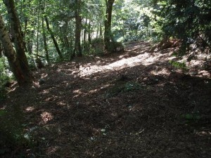
Qwg collaborated with Coastal Geologic Services, under contract with the Northwest Watershed Institute, to remove 1500 feet of forest road, road ditches and drainpipes, two graded building sites, and a bulkhead; restore natural surface water flow patterns; and reduce the risk of debris flows affecting adjacent property. Design and planning for the project used site observations, local well log information, and LiDAR imagery to characterize natural and modified geologic, hydrologic, and geomorphic conditions. Field-developed geologic cross-sections were used to estimate preexisting natural slope gradients, volumes of earth to be excavated and relocated, and approximate area to be mulched and planted. The project has been completed and appears to be holding up well to early winter storms.
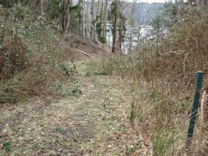
Before
Shoreline Restoration Prioritization and Feasibility Study,
Kitsap Co., WA
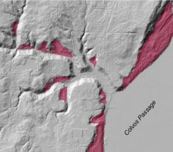
Qwg, in collaboration with two environmental science firms, identified restoration opportunities for Kitsap county, WA through the mapping and characterization of sediment sources, identification of obstructions that impede those sources from contributing to the shoreline environment, and a survey of private landowners to identify those interested in participating in restoration efforts. Mapped sediment sources included a variety of landslide types, as well as select tributary streams based on their morphologic criteria. The inventoried sediment sources were classified and qualitatively rated by relative input volumes and importance to nearshore habitat function. By incorporating public participation, the results of the study guide long-term efforts to select and implement shoreline conservation, bulkhead removal, and restoration of natural physical and biological processes along county shorelines. As of the end of 2014, the project has resulted in >700 ft. of bulkhead removal from public and private shorelands.
Subsequent to the sediment input study, Qwg conducted site feasibility studies for the county, and developed conceptual designs for bulkhead removal and the restoration of several private shoreline properties.
Wilson Creek Salmon Restoration Project,
Kitsap Co., WA

_
Qwg was contracted by a local non-profit group to provide an inventory of sediment-input sources such as old logging roads and bridges, debris flows, and deep-seated landslides. We used field observations and LiDAR to produce detailed maps for the client. We also installed piezometers for stream-adjacent groundwater monitoring to assess the feasibility of creating off-channel salmon rearing habitat.
Geology and Landslide Mapping
of the Tulalip Reservation Shoreline,
Snohomish Co., WA
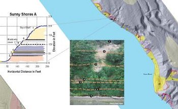
Qwg provided detailed mapping of the glacial stratigraphy and unstable landforms of over 18 miles of natural and developed shoreline for the Tulalip Tribes. Collaboratively with the tribal GIS specialist, we developed new methods to spatially and accurately represent geologic contacts exposed in near vertical bluffs. Mapping products are being used to develop shoreline habitat inventories, design shoreline restoration projects, and evaluate shoreline and upland land-use permit applications.
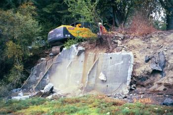
Woodard Bay-Weyer Point Natural Area Preserve Bulkhead Removal and Site Restoration,
Thurston Co, WA

_
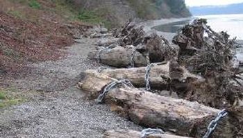
Through a grant partnership between the Washington State Departments of Ecology and Natural Resources, the US Army Corps of Engineers, and The Nature Conservancy, Qwg was contracted to conduct a pre-restoration baseline investigation of the geologic, coastal erosion, and bluff stability to inform site restoration planning. With the results, we initiated and designed the removal of ~200 ft of bulkhead in first the year of restoration, originally scheduled for the 3rd year. This resulted in early project completion and more likely overall project success. Additionally, Qwg designed and implemented a 5-year monitoring plan of sediment sampling, photography, and instrumented surveying, documenting baseline and immediate post-removal beach substrate and bank conditions.
_
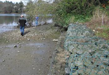
Puget Sound-wide "Soft" Shoreline Stabilization Review, WA

_
_
Under contract with the Puget Sound Action Team (now Puget Sound Partnership), Qwg teamed with a plant ecologist to design and implement the first Puget Sound-wide evaluation of alternative shoreline armoring techniques. We documented triggers for bulkhead permit requests, documented regulatory objectives for initial permit denials and revisions, and established criteria for differentiating between perceived and observed hydrogeologic and coastal geomorphologic concerns. Results of the study were presented in numerous public education workshops and used to inform policy guidance documents on shoreline management.
http://pugetsound.org/science/
Analysis and Design for Capitol Campus Heritage Park Trail,
Olympia, WA

_
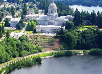
WA Dept. of General Administration photo
Prior to the formation of Qwg, Wendy conducted the geologic mapping and stability analysis of the Washington State Capitol Campus bluffs, and collaborated on the interim low-impact recreational trail design with WA Dept. of Natural Resources engineers. She co-directed drilling investigations for a campus-wide geotechnical study, and subsequently reviewed and made recommendations on consultant design plans for trail upgrades and the Law Enforcement Memorial platform and hill-slope stabilization.
Puget Sound Nearshore Change Analysis,
Puget Sound-wide, WA
Qwg was contracted as a regional expert on coastal geologic/geomorphic processes in support of the primary consultant for the U.S. Army Corps of Engineers. We worked with various Washington State resource agency experts, and advised GIS specialists on the application of an established State Dept. of Ecology shoreline classification system for nearshore landforms.
These data are being used to evaluate and determine restoration priorities for Puget Sound under the direction of the Puget Sound Partnership and the Puget Sound Nearshore Ecosystem Restoration Project (PSNERP).
